HawkEye 360
EO
Operational (nominal)
Communications
Data collection
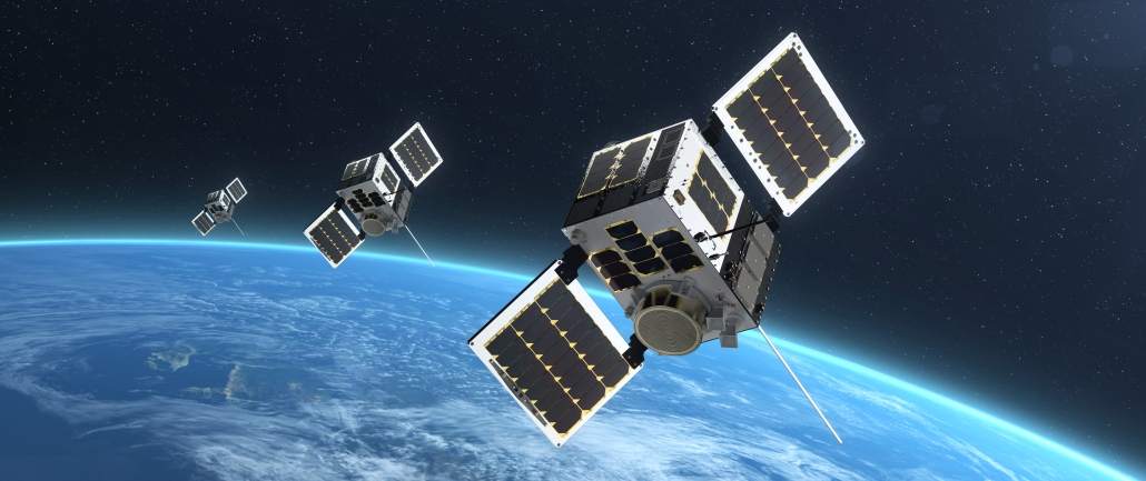
With the initial Pathfinder mission launched in December 2018, HawkEye is a commercially owned and operated constellation of 30 microsatellites developed by HawkEye 360 Inc. The mission provides spaceborne geolocation of radio frequency (RF) emitters, both terrestrial and aerial, for a range of commercial applications. The HawkEye microsatellites are launched in clusters of three.
Quick facts
Overview
| Mission type | EO |
| Agency | HawkEye 360 |
| Mission status | Operational (nominal) |
| Launch date | 03 Dec 2018 |
| Instruments | SDR |
| Instrument type | Communications, Data collection |
| CEOS EO Handbook | See HawkEye 360 summary |
Summary
Mission Capabilities
Each HawkEye microsatellite carries two instruments, a software defined radio (SDR) and an RF front-end module. SDR consists of two components, an embedded processor, and three baseband signal processors. The onboard instruments process radio signals from various sources, enabling HawkEye 360 to detect and analyse RF signals across different frequencies. These instruments capture, filter, and convert the signals into usable data. The system allows for monitoring multiple frequencies at once, covering a wide range of applications.
Customers are primarily paying for the ability to track and analyse RF signals, which can be used for applications such as monitoring maritime activity, managing spectrum usage, and detecting illegal transmissions. This data provides valuable insights for government agencies, telecommunications, and defence sectors.
Performance Specifications
SDR is capable of frequency tuning from 70 MHz to 6 GHz, with two receiver and two transmitter channels, and an instantaneous bandwidth of up to 56 MHz. The two receiver channels are both tuned through a shared local oscillator (LO), limiting the tuning range of a single channel to within 56 MHz, the instantaneous bandwidth of the other. The RF front end’s use of a low noise block (LNB) extends the SDR frequency range to approximately 18 GHz (Ku-band), and quarter-wave dipoles, patches, and wide-band button and horn antennas allow for the desired frequency range, from VHF (Very High Frequency) to Ku-band.
The HawkEye constellation operates in a sun-synchronous orbit of altitude 575 km, inclination 97.77°, with the Pathfinder mission having an LTDN (Local Time on Descending Node) of 1030 hours. The target formation for the constellation positions groups of three spacecraft, creating 7 groups when fully operational, equally spaced along track and 125 km apart, with the middle spacecraft adjusted so that it has peak-to-peak out-of-plane oscillatory motion.
Space and Hardware Components
The HawkEye mission employs the NEMO (Next-generation Earth Monitoring and Observation) platform, developed by UTIAS/SFL (University of Toronto Institute of Aerospace Studies - Space Flight Laboratory), which is already active as part of a range of governmental and commercial missions. The spacecraft has dimensions 0.20 m x 0.20 m x 0.44 m, and a launch wet mass of 13.4 kg. These zones are established through Faraday cage boundaries, to significantly reduce noise. The spacecraft command and data handling (C&DH) is operated by two onboard computers (OBC), which interface with the uplink and downlink radios. The OBCs have different roles, with one responsible for telemetry collection, routing packets to and from the radios, payload operations, and execution of time tagged commands, and the other assigned the roles of polling attitude determination sensors, running the estimation and control algorithms, and commanding actuators.
Overview
HawkEye 360 Inc., based in Herndon, Virginia, successfully launched its HE360 Pathfinder mission in December 2018 to demonstrate its advanced geolocation technology for tracking terrestrial and aerial radio frequency (RF) signals. The mission deployed a cluster of three formation-flying microsatellites into a sun-synchronous orbit at an altitude of 575 km to showcase their high-precision Radio Frequency Interference (RFI) geolocation capabilities. 1)
Following the successful Pathfinder mission, HawkEye 360 developed a commercial satellite constellation to provide global geolocation services. The initial plan involves deploying 18 satellites arranged in six clusters of three, although the final configuration may evolve based on market demand and operational results from the Pathfinder mission. The mission was developed in collaboration with Deep Space Industries (DSI), which provided next-generation propulsion systems, and the Space Flight Laboratory (SFL) at the University of Toronto, which designed and built the spacecraft platforms using their proven NEMO microsatellite bus. 2)
The success of the Pathfinder mission has demonstrated the practicality and effectiveness of HawkEye 360's geolocation technology and paved the way for further expansion, leveraging SFL's precision formation flying technology and DSI's innovations to deliver reliable, high-performance small satellites for commercial applications. 3)
HawkEye 360 is leveraging the rapid growth of RF signals for tracking and analytics. For instance, the ability to detect and analyse RF signals across various bands from space enables telecommunications companies, broadcasters, and regulators to monitor spectrum usage and identify areas of radio frequency interference (RFI). In the transportation sector, RF signals from ships, aircraft, or land vehicles can be tracked to improve safety and logistics. This technology is also valuable in search and rescue operations by quickly locating activated emergency beacons. 3)
RF geolocation involves determining the location of signal emitters on the ground through signal processing and analysis from remote observation platforms—in this case, the three "Hawks" in each HE360 Pathfinder cluster. Each satellite, Hawk-A through Hawk-C, operates in formation to ensure coverage of numerous emitters simultaneously. The system can detect signals even when conventional methods fail, such as when a vessel's Automatic Identification System (AIS) is "spoofed" by bad actors like pirates or illegal fishing fleets to broadcast false GPS locations or when they disable AIS transceivers to evade detection. HawkEye 360 can independently geolocate such vessels using alternative RF signals, providing accurate position data without relying on potentially manipulated information. 3)
The "Hawks" use synchronised GPS receivers to maintain precise timing and stabilise the phase-locked loops (PLLs) that manage the tuning frequency of the RF payloads. By comparing the time of arrival (TOA) and frequency of arrival (FOA) of signals received by different satellites, the system uses multilateration to determine the location of the signal source. This approach allows for accurate geolocation of RF emitters, even in complex environments, enhancing situational awareness and operational capabilities across various sectors.
Spacecraft
The HE360 Pathfinder mission utilises the NEMO-15 bus developed by the Space Flight Laboratory (SFL) at the University of Toronto. This versatile microsatellite platform, which does not conform to a standard cubesat form factor, offers a customizable design with an approximate volume of 20 litres (20U) and a mass of under 15 kg for this mission. The NEMO-15 bus is known for its high performance and reliability, making it a preferred choice for various commercial and government missions.
The NEMO-15 platform has been used by multiple teams, including the Norwegian government's NORSAT-1, -2, and -3 satellites (for scientific, AIS, VDES, and radar applications), the Indian government's NEMO-AM (for aerosol monitoring), and GHGSat Inc. for their constellation of satellites monitoring greenhouse gas emissions. By leveraging the heritage and proven performance of SFL’s platforms, derived from their Generic Nanosatellite Bus (GNB), the Pathfinder mission has minimised costs, schedules, and risks, ensuring a reliable and effective deployment. 4)
The HE360 Pathfinder platform is a compact microsatellite with dimensions of 0.20 x 0.20 x 0.44 m, plus an additional 7 cm mezzanine section, giving it a total launch mass of 13.4 kg. Like CubeSats, it features four launch rails that connect with SFL’s XPOD separation system to guide the satellite during deployment. The structure is primarily made of lightweight magnesium, strategically designed to offer strong mechanical support while keeping the mass low. 5) 6)
The spacecraft utilises a dual-tray structural design, concentrating most avionics towards the +Y side. This layout simplifies integration and cabling and allows for ample space to accommodate payloads. This approach ensures efficient use of internal volume and optimal distribution of weight, providing high mechanical stability and resilience for the mission's demands in orbit. 1) 8)
The Pathfinder spacecraft features a compact, low-mass design utilising a single-string architecture. Its power system is based on SFL’s modular power system (MPS), which harnesses energy from high-efficiency triple-junction solar arrays and stores it in a 12 V lithium-ion battery. The MPS includes a solar array and battery regulator (SABR) for peak power tracking and generates regulated 3.3 V and 5 V buses alongside the unregulated 12 V bus, ensuring load switching and protection against voltage and current anomalies.
Command and Data Handling (C&DH)
The command and data handling system relies on two SFL-designed on-board computers (OBCs). One serves as the housekeeping computer (HKC) for telemetry collection, radio communication, and payload operations, while the other functions as the attitude determination and control computer (ADCC), managing sensor polling and actuator commands. These computers are cross-connected for redundancy, allowing either to assume the other's functions if needed.
Radio Frequency Communication
Telemetry and command communications occur in S-band and UHF. The system includes a UHF receiver for uplink at a fixed 4 kbit/s, while a variable-rate S-band transmitter operates between 32 kbit/s and 2048 kbit/s using BPSK or QPSK modulation. The platform also supports high-data-rate payload links with S-band uplink and X-band downlink capabilities, the latter achieving rates from 3 to 50 Mbit/s. An integrated S-band inter-satellite link demonstrates geolocation capabilities, enabling satellite communication for on-orbit calculations. 4)
Attitude Determination and Control Subsystem (ADCS)
The ADCS employs six sun sensors, a three-axis magnetometer, and a three-axis rate sensor for accurate attitude determination. Control is executed using three vacuum core magnetorquers and three reaction wheels. An L1/L2 GPS receiver measures orbit position and velocity. The system supports various attitude control modes, including de-tumble, inertial pointing, and ground target tracking, achieving 2σ pointing accuracy with errors of 2.1º in sunlight and 4.2º in eclipse. 4)
Propulsion System
The propulsion system, developed by Deep Space Industries (DSI), utilises an electro-thermal design that employs liquid water as the propellant, minimising integration and launch risks compared to traditional systems. With a specific impulse (Isp) of 182 seconds, it offers superior performance to typical cold-gas systems. Although its Isp is lower than some electric propulsion options, its higher thrust enables quasi-impulsive manoeuvres, reducing manoeuvre times. The Pathfinder system has a ΔV capability of 96 m/s and features an expandable propellant tank. To maintain the water propellant in liquid form, the spacecraft’s thermal design is passive, supplemented by auxiliary heaters for emergencies.
Launch
| Spacecraft | Launch Date (UTC) | Launch Site | Launch Provider | Orbit |
Cluster 10 (Hawk-10A, Hawk-10B, Hawk-10C) | August 16, 2024 at 18:56 UTC | Space Launch Complex 4E (SLC-4E), at the Vandenberg Space Force Base (VSFB) in California | SpaceX Transporter-11 | Sun-synchronous orbit of 598 km with an inclination of 97.7º. |
| Cluster 8 (Hawk-8A, Hawk-8B, Hawk-8C), Cluster 9 (Hawk-9A, Hawk-9B, Hawk-9C) | April 7, 2024 at 23:16 UTC | Complex 39A (LC-39A) at Kennedy Space Center in Florida | SpaceX Bandwagon-1 | Low Earth Orbit, with an inclination of 45.6°. Cluster 8 has an altitude of approximately 598 km, and Cluster 9 of approximately 594 km. |
| Cluster 7 (Hawk-7A, Hawk-7B, Hawk-7C) | April 15, 2023 at 06:48 UTC | VSFB | SpaceX Transporter-7 | Low Earth Orbit, with an altitude of approximately 512 km, and an inclination of 97.3°. |
| Cluster 6 (Hawk-6A, Hawk-6B, Hawk-6C) | January 24, 2023 at 22:00 UTC | Launch Complex 2 at Virginia Space’s Mid-Atlantic Regional Spaceport within NASA’s Wallops Flight Facility | Rocket Lab's Electron Rocket | Low Earth Orbit, with an altitude of approximately 558 km, and an inclination of 95.2°. |
| Cluster 5 (Hawk-5A, Hawk-5B, Hawk-5C) | May 25, 2022 at 18:35 UTC | Cape Canaveral, Florida | SpaceX Transporter-5 | Low Earth Orbit, with an altitude of approximately 495 km, and an inclination of 97.6°. |
| Cluster 4 (Hawk-4A, Hawk-4B, Hawk-4C) | April 1, 2022 at 16:24 UTC | Cape Canaveral, Florida | SpaceX Transporter-4 | Low Earth Orbit, with an altitude of approximately 442 km, and an inclination of 97.3°. |
| Cluster 3 (Hawk-3A, Hawk-3B, Hawk-3C) | June 30, 2021 at 19:31 UTC | SLC-40 of Cape Canaveral, Florida | SpaceX Transporter-2 | Sun-synchronous, with an altitude of nearly 550 km. |
| Cluster 2 (Hawk-2A, Hawk-2B, Hawk-2C) | January 24, 2021 at 14:00 UTC | SLC-40 | SpaceX Transporter-1 | Low Earth Orbit, with an altitude of approximately 508.6 km, and an inclination of 97.3°. |
| Cluster 1 (Hawk-A, Hawk-B, Hawk-C) | December 3, 2018 at 18:34 UTC | VSFB | SSO-A ”dedicated rideshare” mission of Spaceflight Industries | Sun-synchronous circular with an altitude of 575 km, LTDN (Local Time of Descending Node) of 10:30 hours. |
Orbit
The HE360 Pathfinder operates in a circular Sun-synchronous orbit at 575 km altitude. The three spacecraft will be spaced 125 km apart along the orbit’s track, with the middle spacecraft exhibiting a 20 km peak-to-peak out-of-plane oscillation at the equator. The formation will become collinear near the poles, where geolocation precision is less critical. No inclination difference is planned due to the high fuel cost of maintaining such corrections. This configuration balances fuel efficiency with optimal viewing geometry for ground target tracking. 3)
The mission requires a formation control accuracy of 5 km (1σ), capable of tolerating one-week ground station outages. While control manoeuvres can be computed on board, they will primarily be ground-based for simplicity. The mission is planned for two years, with a stretch goal of three years. During this time, only two of the three spacecraft will be actively controlled, with manoeuvres spaced at least 45 minutes apart due to power constraints. 5)
Formation control is divided into two phases: initialization and station keeping. After a two-week commissioning period, initialization will take approximately six weeks. Two spacecraft will be manoeuvred into formation, with the selection based on minimising fuel consumption. Spacecraft separation from the launch vehicle will occur five minutes apart, with relative velocities of 1.8 m/s. A guidance plan will determine optimal manoeuvres for the selected spacecraft pair, with control actions allocated over sub-intervals of the initialization phase, allowing time for orbit determination.
During station keeping, the spacecraft will be kept within a designated control window, employing eccentricity/inclination vector separation for passive safety. The process involves a drift period of about one week, followed by four orbits of active control to adjust the semi-major axis and relative eccentricity, ensuring safe drift and minimal drag differences. This approach maximises the time available for payload observations. 5) 6)
Mission Status
- August 16, 2024: Hawk-360 has launched its three Cluster 10 satellites (Hawk-10A, Hawk-10B, Hawk-10C) from Space Launch Complex 4E (SLC-4E), at Vandenberg Space Force Base (VSFB) in California at 18:56 UTC, onboard SpaceX’s Transporter-11 Rideshare mission, on a Falcon-9 rocket. 37)
- April 7, 2024: Hawk-360 has launched its Cluster 8 & 9 satellites (Hawk-8A, Hawk-8B, Hawk-8C, Hawk-9A, Hawk-9B, Hawk-9C) from Launch Complex 39A (LC-39A) at Kennedy Space Center in Florida at 23:16 UTC, onboard SpaceX’s Bandwagon-1 mission, on a Falcon-9 rocket. 39) 47)
- April 15, 2023: Hawk-360 has launched its three Cluster 7 satellites (Hawk-7A, Hawk-7B, Hawk-7C) aboard a SpaceX’s Transporter-7 mission, on a Falcon 9 rocket, from Vandenberg Space Force Base in California, at 06:48 UTC. 46)
- January 24, 2023: Hawk-360 has launched its three Cluster 6 satellites (Hawk-6A, Hawk-6B, Hawk-6C) aboard Rocket Lab's Electron Rocket, from Launch Complex 2 at Virginia Space’s Mid-Atlantic Regional Spaceport within NASA’s Wallops Flight Facility, at 22:00 UTC. 45)
- May 25, 2022: Hawk-360 has launched its three Cluster 5 satellites (Hawk-5A, Hawk-5B, Hawk-5C) aboard SpaceX’s Transporter-5 rideshare mission on a Falcon 9 rocket from Cape Canaveral, Florida, at 18:35 UTC. 35)
- April 1, 2022: Hawk-360 has launched its three Cluster 4 satellites (Hawk-4A, Hawk-4B, Hawk-4C) aboard SpaceX’s Transporter-4 rideshare mission (40 satellites) with a Falcon 9 rocket from Cape Canaveral, Florida, at 16:24 UTC. 10)
- October 12, 2021: HawkEye 360’s third cluster of satellites, launched aboard a SpaceX Falcon 9 on June 30, has achieved operational capability, delivering RF data to clients. The addition of Cluster 3 brings the total number of HawkEye 360 satellites to nine. These satellites feature redundant systems, enhanced geolocation accuracy, and expanded RF frequency coverage. 17)
- October 5, 2021: HawkEye 360 satellites are being used to detect GPS interference across regions like the Mediterranean. The satellites fly in clusters of three, tracking RF signals to locate GNSS interference. At the 2021 GEOINT Symposium, COO Rob Rainhart explained that their RF data helps both government and commercial clients address GPS disruptions. 18)
- September 30, 2021: HawkEye 360 secured over $50 million in contracts in 2021, driven by increased customer demand. The company’s RF satellites enable insights into national security, maritime awareness, and environmental protection. 19)
- June 30, 2021: HawkEye Cluster 3 satellites successfully deployed and established communication, enhancing their RF-sensing satellite constellation. 20)
- April 14, 2021: HawkEye 360 raised $55 million to complete its satellite constellation, tracking ships and vehicles via radio-frequency (RF) emissions. The funding, led by NightDragon and other investors, will support the launch of three additional satellite clusters, ground infrastructure, and data processing. 21) 22)
- March 31, 2021: HawkEye 360’s “Cluster 2” satellites achieved initial operational capability after being launched in January 2021. The satellites provide improved RF geolocation, GPS interference monitoring, and increased data collection capacity. Cluster 2 will support government, commercial, and humanitarian customers with global RF data and analytics. 23)
- February 11, 2021: HawkEye 360 launched Mission Space, a platform for RF geospatial intelligence analysis. The platform simplifies RF signal analysis, allowing users to visualise, manipulate, and explore data trends and patterns. It enhances situational awareness for defence, intelligence, and commercial sectors through automated RF data insights. 24)
- February 4, 2021: HawkEye 360 introduced the HawkEye RF Data Explorer, an add-in for Esri’s ArcGIS Pro software. It integrates RF geospatial intelligence into Esri’s GIS platform, allowing analysts to visualise and analyse RF data by area, timeframe, and signal type. Users can track maritime activities, such as vessel identity, voyage history, and sanctions violations, and automate monitoring through watch lists. 25)
- December 16, 2020: HawkEye 360 is supporting a commercial RF geospatial intelligence (GEOINT) pilot program with the U.S. National Geospatial-Intelligence Agency (NGA). The program tests RF data for GEOINT applications, including tipping and cueing for electro-optical and radar imaging satellites. U.S. combatant commands use the data to enhance maritime awareness and cooperation with regional allies through unclassified, shareable analytics. 26)
- July 28, 2020: HawkEye 360 launched a Regional Awareness Subscription (RAS) service using its RFGeo product to provide large-scale RF signal mapping and situational awareness. RAS helps organisations monitor and analyse RF signal behaviour across regions like the Mediterranean, South China Sea, and the Korean Peninsula, delivering data in GeoJSON format. Customers gain daily RF data collection to enhance intelligence, historical analysis, and geospatial solutions. 27)
- June 25, 2020: HawkEye 360 expanded the RFGeo product to map an extended catalogue of marine navigation radar signals. This update includes S-band radar signals and quadruples the number of X-band radar signals, improving maritime situational awareness and helping track vessels engaged in illicit activities, such as smuggling or illegal fishing. 28)
- March 3, 2020: A model of HawkEye 360’s Pathfinder satellite was added to the Smithsonian’s National Air and Space Museum’s permanent collection, representing the importance of small satellites in space technology. The satellite cluster has geolocated over 11 million RF signals, supporting national security and tracking dark ships. 29)
Sensor Complement
Each spacecraft is equipped with an identical payload, which consists of two main components: an SDR (Software Defined Radio) featuring an embedded processor, FPGA, and baseband signal processor, and a custom RF front-end integrated with antennas.
SDR (Software Defined Radio)
The SDR, deployed on the Pathfinder satellites, incorporates an embedded processor system alongside three baseband processors based on the Analog Devices 9361 RF transceiver. This highly integrated device offers a tuning range from 70 MHz to 6 GHz, with the capability to handle an instantaneous bandwidth of 56 MHz. The design allows for processing across three independent receive channels, enabling simultaneous reception on distinct frequencies. At the heart of the SDR is the Xilinx Zynq 7045 SOC, which combines a dual-core ARM processor and a Kintex FPGA on a single chip. This tight integration facilitates efficient cross-domain switching between processing and FPGA tasks, which is particularly beneficial for advanced signal processing applications. 9)
RF Front-End
The custom RF front-end, designed by HawkEye 360, connects seamlessly to the baseband processors. It features several unique, switchable RF paths equipped with tailored filters, low noise amplifiers (LNAs), and attenuators designed for specific frequency bands of interest. Notably, a low noise block down-converter (LNB) is included to extend the SDR’s operational frequency range up to Ku-band (~18 GHz). A diverse array of antennas, including quarter-wave dipoles, patch antennas, and wide-band button and horn antennas, supports operations across the full frequency spectrum from VHF to Ku-band.
To maximise the SDR's effectiveness, the processing system leverages open-source signal processing software and firmware, primarily using GNURadio, which is a well-regarded toolkit for software-defined radio applications. This approach allows for flexible ground development, independent of the final space hardware, and promotes a "fly as you try" philosophy. In operational scenarios, the payload can be commanded to tune the baseband processor to a designated centre frequency, streaming complex (quadrature) samples at specified sample rates. The RF front-end is also configurable based on the signals of interest.
The onboard processing capabilities are enhanced through the FPGA, which handles initial signal conditioning, including filtering and balancing of ADC outputs. However, to ensure efficiency, HawkEye 360 emphasises maximising on-board processing to deliver valuable insights while minimising the need for extensive data downlinking. This involves transforming full RF data into metadata tailored to user-defined signal processing chains optimised for the embedded platform.
The payload has undergone extensive in-field aerial testing during its development phase, significantly boosting confidence prior to the Pathfinder mission launch. The SDR payloads and receiving antennas were fitted onto three rented aircraft, flown in various formations over active RF emitters, including maritime vessels and commercial maritime radar systems. These tests yielded RF signal detection and geolocation with unprecedented accuracy, demonstrating the system’s potential for real-world applications. 10)
Ground Segment
HawkEye 360 leverages commercial Earth station services, specifically partnering with Kongsberg Satellite Service (KSAT) since April 2018. KSAT is renowned for its ground station communication services tailored for low Earth orbit (LEO) satellites, particularly those in polar orbits. Their Svalbard Ground Station, located at a high latitude of 78º North, stands out as the largest commercial ground station globally, enabling support for satellites in all orbits.
By utilising the Svalbard facility, HawkEye 360 ensures the timely reception of data, which is crucial for operational effectiveness. The mission will implement KSAT's KSAT Lite platform, an advanced solution that not only streamlines satellite communications but also allows HawkEye 360 to connect with additional ground stations in KSAT's expansive network. This collaboration enhances the delivery speed and reliability of data, thereby significantly boosting the mission's operational capabilities. 30)
References
1) K. Sarda, N. Roth, R. E. Zee, Dan CaJacob, Nathan G. Orr, ”Making the Invisible Visible: Precision RF-Emitter Geolocation from Space by the HawkEye 360 Pathfinder Mission,” Proceedings of the 32nd Annual AIAA/USU Conference on Small Satellites, Logan UT, USA, Aug. 4-9, 2018, paper: SSC18-II-06, URL: https://digitalcommons.usu.edu/cgi/viewcontent.cgi?article=4075&context=smallsat
2) Russ Matijevich, ”Making The Invisible... Visible,” SatMagazine, September 2016, URL: http://www.satmagazine.com/story.php?number=2060893990
3) G. Bonin, N. Roth, S. Armitage, J. Newman, B. Risi, R. E. Zee, “CanX-4 and CanX-5 Precision Formation Flight: Mission Accomplished!”, Proceedings of the 29th Annual AIAA/USU Conference on Small Satellites, Logan, Utah, USA, August 8-13, 2015, paper: SSC15-I-4, URL: https://digitalcommons.usu.edu/cgi/viewcontent.cgi?article=3167&context=smallsat
4) Daniel CaJacob, Nicholas McCarthy, Timothy O’Shea, Robert McGwier, ”Geolocation of RF Emitters with a Formation-Flying Cluster of Three Microsatellites,” Proceedings of the 30th Annual AIAA/USU SmallSat Conference, Logan UT, USA, August 6-11, 2016, paper: SSC16-VI-5, URL: https://digitalcommons.usu.edu/cgi/viewcontent.cgi?article=3379&context=smallsat
5) Josh Newman, Robert E. Zee, “Drift Recovery and Station Keeping Results for the Historic CanX-4/CanX-5 Formation Flying Mission”, Proceedings of the 29th Annual AIAA/USU Conference on Small Satellites, Logan, Utah, USA, August 8-13, 2015, paper: SSC15-VIII-1, URL: https://digitalcommons.usu.edu/cgi/viewcontent.cgi?article=3218&context=smallsat
6) G. Gaias, S. D’Amico, J.-S. Ardaens, ”Generalized Multi-Impulsive Maneuvers for Optimum Spacecraft Rendezvous,” 5th International Conference on Spacecraft Formation Flying Missions and Technologies, Munich, Germany, 30 May 2013, URL: https://pdfs.semanticscholar.org/7c2d/421723cfd75722ddaa987d3d9f4f4727197e.pdf
7) Christopher W. T. Roscoe, Jason J. Westphal, Jacob D. Griesbach, Hanspeter Schaub, ”Formation Establishment and Reconfiguration Using Differential Elements in J2-Perturbed Orbits,” Journal of Guidance, Control, and Dynamics, Vol. 38, No. 9, pp. 1725-1740, Sept. 2015, https://doi.org/10.2514/1.G000999
8) Simone D'Amico; Oliver Montenbruck, ”Proximity Operations of Formation-Flying Spacecraft Using an Eccentricity/Inclination Vector Separation", Journal of Guidance, Control, and Dynamics, Vol. 29, No. 3 (2006), pp. 554-563, https://doi.org/10.2514/1.15114
9) K. Sarda, R. E. Zee, Dan CaJacob, Nathan G. Orr, ”Making the Invisible Visible: Precision RF-Emitter Geolocation from Space by the HawkEye 360 Pathfinder Mission,” Proceedings of the 69th IAC (International Astronautical Congress) Bremen, Germany, 1-5 October 2018, paper: IAC-18-B4.4.1, URL: https://iafastro.directory/iac/proceedings/IAC-18/IAC-18/B4/4/manuscripts/IAC-18,B4,4,1,x42239.pdf
10) ”HawkEye 360’s Cluster 4 Satellites Successfully Travel To Orbit,” Satnews, 4 April 2022, URL: https://news.satnews.com/2022/04/04/hawkeye-360s-cluster-4-satellites-successfully-travel-to-orbit/
11) Jeff Foust, ”SpaceX launches second dedicated rideshare mission,” SpaceNews, 30 June 2021, URL: https://spacenews.com/spacex-launches-second-dedicated-rideshare-mission/
12) ”HawkEye Cluster 2 — The launch of HawkEye Cluster 2 from Cape Canaveral kick-starts a new era for RF geospatial intelligence with the most advanced commercial constellation.,” HawkEye360, 24 January 2021, URL: [web source no longer available]
13) ”HawkEye 360 Announces Successful Launch of First Three Satellites,” HawkEye 360, 3 December 2018, URL: http://www.he360.com/hawkeye-360-announces-successful-launch-of-first-three-satellites/
14) Stephen Clark, ”Spaceflight’s 64-satellite rideshare mission set to last five hours,” Spaceflight Now, 3 December 2018, URL: https://spaceflightnow.com/2018/12/03/spaceflights-64-satellite-rideshare-mission-set-to-last-five-hours/
15) Stephen Clark, ”Spaceflight preps for first launch of unique orbiting satellite deployers,” Spaceflight Now, 23 August 2018, URL: https://spaceflightnow.com/2018/08/23/spaceflight-preps-for-first-launch-of-unique-orbiting-satellite-deployers/
16) ”Spaceflight SSO-A: SmallSat Express Mission,” SpaceX, 3 December 2018, URL: https://web.archive.org/web/20181204085402/https://www.spacex.com/news/2018/12/03/spaceflight-sso-smallsat-express-mission
17) ”HawkEye 360’s Third Satellite Cluster Begins Commercial Operations,” HawkEye 360, Press Release 12 October 2021, URL: https://www.he360.com/hawkeye-360s-third-satellite-cluster-begins-commercial-operations/
18) Sandra Erwin,”Space data used to detect sources of GPS disruptions,” SpaceNews, 5 October 2021, URL: https://spacenews.com/space-data-used-to-detect-sources-of-gps-disruptions/
19) ”HawkEye 360 Reaches Contractual Milestone for Delivering Space-based Radio Frequency Mapping,” HawkEye 360 Press Release, 30 September 2021, URL: https://www.he360.com/hawkeye-360-reaches-contractual-milestone-for-delivering-space-based-radio-frequency-mapping/
20) ”HawkEye 360 Successfully Launches Next Generation RF Satellites,” HawkEye 360, 30 June 2021, URL: https://www.he360.com/hawkeye-360-successfully-launches-next-generation-rf-satellites/
21) Jeff Foust, ”HawkEye 360 raises $55 million,” SpaceNews, 14 April 2021, URL: https://spacenews.com/hawkeye-360-raises-55-million/
22) ”HawkEye 360 Secures $55 Million Series C Funding Round,” HawkEye Press Release, 12 April 2021, URL: https://www.he360.com/hawkeye-360-secures-55-million-series-c-funding-round/
23) ”HawkEye 360 Announces Commissioning of Second Satellite Cluster,” HawkEye 360, 31 March, 2021, URL: https://www.he360.com/hawkeye-360-announces-commissioning-of-second-satellite-cluster/
24) ”HawkEye 360 Introduces the Mission Space Platform for Analysis of Radio Frequency Geospatial Intelligence,” HawkEye 360 Press Release, 11 February 2021, URL: https://www.he360.com/hawkeye-360-introduces-the-mission-space-platform-for-analysis-of-radio-frequency-geospatial-intelligence/
25) ”HawkEye 360 Introduces “HawkEye RF Data Explorer” for Esri ArcGIS to Improve the Accessibility of Radio Frequency Intelligence,” HawkEye360 Press Release, 4 February 2021, URL: https://www.he360.com/hawkeye-360-introduces-hawkeye-rf-data-explorer-for-esri-arcgis-to-improve-the-accessibility-of-radio-frequency-intelligence/
26) ”HawkEye 360 Supporting NGA’s RF Geoint Pilot Program,” Satnews, 16 December 2020, URL: https://news.satnews.com/2020/12/16/hawkeye-360-supporting-ngas-rf-geoint-pilot-program/
27) ”HawkEye 360 Announces a Global Radio Signal Monitoring Service,” HawkEye360 Press Release, 28 July 2020, URL: https://www.he360.com/hawkeye-360-announces-a-global-radio-signal-monitoring-service/
28) ”New HawkEye 360 Radar Signals Delivers Comprehensive Maritime Awareness,” HawkEye 360, 25 June 2020, URL: https://www.he360.com/new-hawkeye-360-radar-signals-delivers-comprehensive-maritime-awareness/
29) ”HawkEye 360 Pathfinder Selected for Exhibition in New Smithsonian Gallery,” HawkEye360 Press Release, 3 March 2020, URL: https://www.he360.com/hawkeye-360-pathfinder-selected-for-exhibition-in-new-smithsonian-gallery/
30) ”HawkEye 360 Selects Norway’s Kongsberg Satellite Service (KSAT) to Provide Ground Station Services for Pathfinder Mission,” HawkEye 360, 18 April 2018, URL: http://www.he360.com/hawkeye-360-selects-norways-kongsberg-satellite-service-ksat-to-provide-ground-station-services-for-pathfinder-mission/
31) Gunter’s Space Page, “Hawk 2A-C, ..., 10A-C”, URL: https://space.skyrocket.de/doc_sdat/hawk-2a.htm
32) Foust Jeff, “SpaceX launches record-setting cluster of smallsats”, SpaceNews, January 24, 2021, URL: https://spacenews.com/spacex-launches-record-setting-cluster-of-smallsats/
33) n2yo.com, “HAWK-2A”, URL: https://www.n2yo.com/satellite/?s=47505
34) n2yo.com, “HAWK-4A”, URL: https://www.n2yo.com/satellite/?s=52167
35) Navin Joseph, “SpaceX launches Falcon 9 on Transporter-5 Rideshare Mission”, NASASpaceFlight, May 25, 2022, URL: https://www.nasaspaceflight.com/2022/05/transporter-5-launch/
36) n2yo.com, “HAWK-5A”, URL: https://www.n2yo.com/satellite/?s=52757
37) HawkEye360, “HawkEye Cluster 10”, August 16, 2024, URL: https://www.he360.com/launches/cluster-10-launch/
38) Christiaens Kris, “Hawk (HawkEye 360)”, FutureSpaceFlight, October 29, 2023, URL: https://www.futurespaceflight.com/satellites/hawk-hawkeye-360.html
39) HawkEye360, “HawkEye Cluster 8 & 9”, April 7, 2024, URL: https://www.he360.com/launches/cluster-8-9-launch/
40) n2yo.com, “HAWK-6A”, URL: https://www.n2yo.com/satellite/?s=55327
41) n2yo.com, “HAWK-7B”, URL: https://www.n2yo.com/satellite/?s=56193
42) n2yo.com, “HAWK-8A”, URL: https://www.n2yo.com/satellite/?s=59443
43) n2yo.com, “HAWK-9A”, URL: https://www.n2yo.com/satellite/?s=59446
44) n2yo.com, “HAWK-10B”, URL: https://www.n2yo.com/satellite/?s=60545
45) HawkEye360, “HawkEye Cluster 6”, January 24, 2023, URL: https://www.he360.com/launches/cluster-6-launch/
46) HawkEye360, “HawkEye Cluster 7”, April 14, 2023, URL: https://www.he360.com/launches/cluster-7-launch/
47) SpaceX, “Bandwagon-1 Mission”, April 7, 2024, URL: https://www.spacex.com/launches/mission/?missionId=bandwagon-1