MOS (Marine Observation Satellite) Constellation / Momo
EO
JAXA
Atmosphere
Ocean
The MOS (Marine Observation Satellite) Constellation, made up of MOS-1 and 1B, were Japan’s first marine observation satellites, owned and operated by NASDA (National Space Development Agency of Japan). MOS-1 and 1B launched in February 1987 and February 1990, and finished their operations in November and April 1996, respectively.
Quick facts
Overview
| Mission type | EO |
| Agency | JAXA, NASDA |
| Mission status | Mission complete |
| Launch date | 19 Feb 1987 |
| End of life date | 17 Apr 1996 |
| Measurement domain | Atmosphere, Ocean, Land, Snow & Ice |
| Measurement category | Cloud type, amount and cloud top temperature, Multi-purpose imagery (ocean), Multi-purpose imagery (land), Atmospheric Humidity Fields, Snow cover, edge and depth |
| Measurement detailed | Ocean imagery and water leaving spectral radiance, Cloud cover, Cloud imagery, Land surface imagery, Snow cover, Water vapour imagery |
| Instruments | DCS (JAXA), MESSR, MSR, VTIR |
| Instrument type | Imaging multi-spectral radiometers (vis/IR), Imaging multi-spectral radiometers (passive microwave), Data collection |
| CEOS EO Handbook | See MOS (Marine Observation Satellite) Constellation / Momo summary |
Summary
Mission Capabilities
Both satellites housed the same instruments: a Multi-spectral Electronic Self-Scanning Radiometer (MESSR), designed to provide information on coastal zone dynamics, water resources, vegetation dynamics, and geological applications; a Microwave Scanning Radiometer (MSR), that provided information on sea ice, snowfall, and water vapour content at the ocean and in the atmosphere, and a Visible and Thermal Infrared Radiometer (VTIR) that measured sea-surface temperature.
Performance Specifications
MESSR was a four-band pushbroom radiometer, with one visible (VIS) spectral band and three thermal infrared (TIR) bands, creating a 50 m Ground Sample Distance (GSD) and a combined swath width of 200 km. For increased reliability of data, two sets of MESSRs were used on the spacecraft, each with swath widths of 100 km. The instrument could achieve global coverage in 17 days.
MSR was a passive microwave radiometer consisting of an offset Cassegrain-type antenna, a sky horn, two Dicke-type receivers, and two detectors operating at different frequencies. The antenna scanned mechanically to follow a conical path, oscillating 10° either side of nadir. The two channels operated at respective frequencies of 24 GHz and 31 GHz, and corresponding ground resolutions of 32 km and 23 km, providing global coverage in 5 days. Data from MSR was transmitted at a rate of 2000 MHz to the Earth Observation Center in Japan and to other overseas Earth observation stations for processing.
VTIR was a mechanical-scanning radiometer with four spectral bands that used a rotating mirror and Ritchey-Chretien optics, providing three TIR spectral bands and one VIS band for observations. The instrument scanned cross-track swaths 1500-km wide, with along-track scans provided by the motion of the spacecraft. VTIR had a ground resolution of 0.9 km for the VIS band with daily global coverage, and 2.7 km for the TIR bands with global coverage in 2 days.
The two MOS satellites operated in a Sun-synchronous orbit at an altitude of 909 km, with a period of 103 minutes.
Space and Hardware Components
The two satellites had dimensions 1.26 x 1.48 x 2.40 m with aluminium honeycomb construction and featured singular 1.51 m solar arrays. The spacecraft consisted of a bus module and a mission module, featuring momentum wheels and hydrazine thrusters to provide three-axis stabilisation, and had communications provided by S and X-band downlink and S-band uplink. The satellites had design lives of two years, and a launch mass of 745 kg for MOS-1 and 740 kg for MOS-1b.
Marine Observation Satellite (MOS) Constellation
Overview
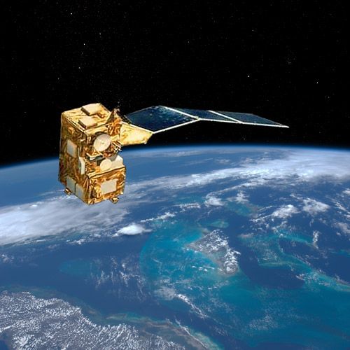
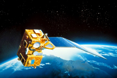
The MOS-1 and 1B satellites comprised the MOS Constellation, also known as Momo (or “Peach tree”), and were Japan’s first Earth resources satellites. The constellation was developed by NASDA (National Space Development Agency of Japan), now JAXA (Japan Aerospace Exploration Agency)) for natural resource utilisation and environmental protection. MOS-1 was Japan’s first marine observation satellite, and MOS-1B was a follow-up mission to MOS-1, with the same functions and instruments. 1)
The MOS Constellation was designed to monitor ocean currents, sea surface temperature, atmospheric water vapour, ocean chlorophyll levels, precipitation, and land vegetation. Payload data from the satellites was transmitted in real-time to the Hatoyama Earth Observation Center for processing and is available through the Data Service Department, Remote Sensing Technology Center of Japan (RESTEC). 2)
After 10 years of development, MOS-1 was launched in February 1987, followed by MOS-1B in February 1990, into an orbital plane only a few degrees away from MOS-1. The MOS programme's objectives included: the development of observation sensors, with verification of their functions and performance in Earth observation; basic experiments on a data collection system (DCS); and establishment of fundamental technologies for Earth observation satellites.
Spacecraft
The MOS spacecraft had a box-shape of aluminium honeycomb construction with dimensions 1.26 x 1.48 x 2.40 m and a singular solar array of three 1.51 m wide panels with 1-axis articulation providing power. It was composed of two modules: a bus module and a mission module, on which the three instruments were mounted. Both satellites were nadir-pointing, three-axis stabilised and controlled by momentum wheels and four hydrazine thrusters. Communications consisted of S-, X-band downlink, and S-band uplink, with mission design lives of 2 years. MOS-1 and 1B had respective launch masses of 745 kg and 740 kg. 2) 3) 4) 5)
The MOS programme, funded and operated by NASDA, selected the Nippon Electric Company (NEC), headquartered in Minato, Tokyo, to be the prime contractor with significant assistance by Mitsubishi Electric, Toshiba, and Fujitsu.
Data Collection System (DCS)
The experimental Data Collection System (DCS) Transponder was used to collect observation data from Data Collection Platforms (DCPs) such as drifting buoys, based on the Doppler frequency of received signals. Data from DCPs was transmitted at 400 MHz to a down-converter in the DCS, and the output signal was then transmitted with phase modulation by a 1700-MHz link to the Earth Observation Center in Japan. The DCS transponder was designed to be a pathfinder for the Japanese Tracking and Data Relay Satellite System (TDRSS). 2) 6)
Launch
MOS-1 was launched on 19 February 1987, at 01:23 UTC on the N-2 launch vehicle from Tanegashima, Japan.
Orbit: Sun-synchronous, with an altitude of 909 km, period of 103 minutes, inclination of 99.1°, and a descending node between 10:00 and 11:00 local time. 3) 7)
MOS-1B was launched on 7 February 1990, at 01:33 UTC on the H-2 launch vehicle from Tanehashima, Japan.
Orbit: slight elliptical sun-synchronous, with perigee 909 km, apogee 940km and eccentricity 0.00212. The period was 103 minutes, and an inclination of 99.0°. 8)
Mission Status
- MOS-1 finished operations on 19 November, 1996. 5)
- MOS-1B finished operations on 25 April, 1996, due to degradation of batteries. 5)
Sensor Complement
MOS-1 and 1B housed a suite of radiometers, a Multispectral Electronic Self-Scanning Radiometer (MESSR) that collected data from both land and sea, a Microwave Scanning Radiometer (MSR) that provided information on sea ice, snowfall, and water vapour content at the ocean and in the atmosphere, and a Visible and Thermal Infrared Radiometer (VTIR) that measured sea-surface temperature.
MESSR (Multi-spectral Electronic Self-Scanning Radiometer)
MESSR was a four-band pushbroom radiometer that measured sea-surface colour, the distribution of ice flow and chlorophyll, and the generation of “red tides”, a phenomenon caused by algal blooms in which algae become so numerous that they discolour coastal waters, deplete oxygen and release toxins into the water. The 140 kg instrument was also used for detection of mineral and energy resources, crop inventories, and other land observations. 2)
VIS (Visible) | 0.51 - 0.59 μm |
VIS | 0.61 - 0.69 μm |
NIR (Near-Infrared) | 0.72 - 0.80 μm |
NIR | 0.80 - 1.10 μm |
FOV (Instantaneous) | 54.7 μradians |
GSD (Ground Sample Distance) | 50 m |
Swath Width | 100 km x 2 km along track (combined 200 km) |
Data Transmission frequency | 8000 MHz |
Global Coverage | 17 days |
The pushbroom radiometer received incoming radiation by two optical systems, each composed of a Gauss type telescope, a prism to divide the incident rays into two parts (depending on wavelength), and two charge-coupled device (CCD) detectors with 2048 elements. For increased reliability of data, two sets of MESSRs were incorporated, creating a total swath width of 200 km for all four spectral bands. Image data was converted by signal processors to digital format, and then downlinked via 8000 MHz transmitters at a rate of 8 Mbit/s to the Earth Observation Center in Japan as well as overseas ground stations. 10)
MSR (Microwave Scanning Radiometer)
MSR was a passive microwave radiometer with two frequency channels designed to provide information on snow cover and sea-ice extent, atmospheric liquid water and water vapour content, ocean wind speed and large-scale sea surface temperature. The 54 kg instrument consisted of an offset Cassegrain-type antenna, a sky horn, two Dicke-type receivers, and two detectors operating at different frequencies.
The antenna scanned mechanically, with the offset parabolic reflector rotating at 18 rpm (revolutions per minute) to follow a conical path, oscillating 10° either side of nadir. Both channels provided 1.5° K radiometric resolution and a dynamic range of 30 - 330° K at a data rate of 2 kbps, with global coverage in 5 days. Data from MSR, including range and rate signals, was transmitted at a rate of 2000 MHz to the Earth Observation Center in Japan and to other overseas earth observation stations for processing. 11)
Parameter | Channel 1 | Channel 2 |
Integration Time | 10 μs | 47 μs |
Frequency | 23.8 GHz | 31.4 GHz |
Polarisation | Horizontal | Vertical |
Ground Resolution | 32 km | 23 km |
Swath Width (along track) | 317 km | 317 km |
Beam Width | <1.99° | <1.45° |
VTIR (Visible and Thermal Infrared Radiometer)
VTIR was a mechanical-scanning radiometer with four spectral bands that provided information on snowpack mapping, water vapour distribution, cloud cover mapping, ocean currents, sea surface temperature, and sea ice dynamics. The 25 kg instrument was a mechanical reflecting mirror that rotated at a rate of 7.3 rps (revolutions per second), and housed Ritchey-Chretien optics. The instrument scanned cross-track swaths 1500-km wide, with along-track scans provided by the motion of the spacecraft.
VIS | 0.5 - 0.7 μm |
TIR (Thermal Infrared) | 6.0 - 7.0 μm |
TIR | 10.5 - 11.5 μm |
TIR | 11.2 - 12.5 μm |
The visible band made use of silicon photodiodes, and the infrared bands used mercury-cadmium-telluride elements.
Swath Width (cross track) | 1500 km | |
FOV (Instantaneous) | 1 mradian (VIS) | 3 mradians (TIR) |
Ground Resolution | 900 m (VIS) | 2700 m (TIR) |
Global Coverage | Daily (VIS) | 2 Days (TIR) |
Radiometric Resolution | 0.5° K | |
The primary image produced at the image plane was spectrally separated by the optical filters and relayed to detectors for photo-electric conversion. The converted image data was transmitted at 8000 MHz to the Earth Observation Center in Japan and to other foreign stations for processing. 12)
References
1) “About Marine Observation Satellite-1 “Momo-1” (MOS-1),” JAXA, URL: https://global.jaxa.jp/projects/sat/mos1/index.html
2) “MOS-1B,” NASA, 28 October 2022, URL: https://nssdc.gsfc.nasa.gov/nmc/spacecraft/display.action?id=1990-013A
3) “MOS-1,” NASA, 28 October 2022, URL: https://nssdc.gsfc.nasa.gov/nmc/spacecraft/display.action?id=1987-018A
4) “Marine Observation Satellite,” Encyclopedia Astronautica, URL: http://www.astronautix.com/m/marineobsertionsatellite.html
5) “Satellite Programme: Marine Observation Satellite,” WMO OSCAR, URL: https://space.oscar.wmo.int/satelliteprogrammes/view/mos
6) “Data Collection System Transponder (DCS Transponder),” NASA, 28 October 2022, URL: https://nssdc.gsfc.nasa.gov/nmc/experiment/display.action?id=1987-018A-04
7) “MOS-1 Launch Information,” NASA, 28 October 2022, URL: https://nssdc.gsfc.nasa.gov/nmc/spacecraft/displayTrajectory.action?id=1987-018A
8) “MOS-1B Launch Information,” NASA, 28 October 2022, URL: https://nssdc.gsfc.nasa.gov/nmc/spacecraft/displayTrajectory.action?id=1990-013A
9)“Data Collection System Transponder (DCS Transponder),” NASA, 28 October 2022, URL: https://nssdc.gsfc.nasa.gov/nmc/experiment/display.action?id=1987-018A-04
10) “Multispectral Electronic Self Scanning Radiometer (MESSR),” NASA, 28 October 2022, URL: https://nssdc.gsfc.nasa.gov/nmc/experiment/display.action?id=1990-013A-01
11) “Microwave Scanning Radiometer (MSR),” NASA, 28 October 2022, URL: https://nssdc.gsfc.nasa.gov/nmc/experiment/display.action?id=1990-013A-03
12) “Visible and Thermal Infrared Radiometer (VTIR),” NASA, 28 October 2022, URL: https://nssdc.gsfc.nasa.gov/nmc/experiment/display.action?id=1990-013A-02